|
Stavich Bicycle Trail |
one moment while we fetch a trail picture
|
|
|
Stavich Bicycle Trail |
one moment while we fetch a trail picture
|

An asphalt surface carries you through farmland and woods along the Mahoning River. The trail corridor originally served the Penn-Ohio interurban trolley line rather than a railroad. Trolleys are more forgiving about gradients than railroads, so the trail has noticeable (but still gentle) slopes. The only scenic drawback is the existing trackage of the Pennsylvania and Lake Erie railroad, especially the switch yard near Struthers. Much of this track has been salvaged, though two tracks are still in use. Most of the trail runs through woods and some farms with occasional houses near the trail. In Pennsylvania mileposts have different numbers on opposite sides. One set counts from zero at the State border and the other counts from zero from Washington Street. The two values will add up to seven. For this write up we will use miles from Washington St.
The trail starts on W Washington St in the outskirts of New Castle and immediately drops 10 ft, passing MP zero 30 feet from the road. The trail head parking is 0.2 miles from this start at MP0.2. From the parking lot at the trail head, turn left to travel the 0.2 miles to the start and get EFI (Every Fine Inch). Turn right to head towards Lowellville. Just past MP 2.1, a beaver dam is blocking a culvert intake to create a lake and marsh on the north side of the trail. We have seen ducks, geese and other water birds, but have not yet seen the beavers. Around MP5.7 the trail reminds you that this was a trolley track, rather than a railroad. The trail climbs a hill at a much steeper grade then allowed for a railroad. At mile MP7 the trail crosses into Ohio and there are no more mile markers. Renovation of the Pennsylvania section in 2010 left a smooth asphalt surface (2025).In Ohio, MP7.2 there is a pond with lots of duck weed and an occasional duck. Between MP7.5 and MP8 the trail is on Liberty St in Lowellville, affording an opportunity for lunch in the parklet, across from City Hall on the opposite side of the railroad. You can buy subs at Ross’ Market on Liberty St, a block west of the parklet. Although this short stretch is on roads, traffic is very light and slow, except caution is required at the intersection with 1st St, as traffic coming down the hill is moving pretty fast and there is no stop sign.
Shortly after leaving town, there is a school and sports complex on the right. The trail ends at mile MP10 in a small parking lot overlooking the remains of the Struthers switchyard. The sign in theparking lot says there is 14.9 miles of trail, but we could only find the 10 miles described here.
The trail is largely exposed to the sun, making it a good bet for early and late in the season, but a real oven in the summer. Wildflower displays in season are very fine.
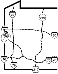
| Location | New Castle PA to Struthers OH, Union and Mahoning Townships in Lawrence | ||
| Trailheads | New Castle PA, Lowellville OH, Struthers OH | ||
| Length, Surface | 10.0 miles paved; 7.0 paved 2009, 3.0 older | ||
| Character | Busy, rural, sunny, rolling | ||
| Usage restrictions | No motorized vehicles; no horses | ||
| Amenities | Water, food | ||
| Driving time from Pittsburgh | 1 hours 1 minutes |